When most buyers check flood risk, they pull up FEMA's Flood Map Service Center. If the map shows Zone X (minimal risk), they breathe easy. This is a dangerous oversimplification — FEMA flood maps are a legal and insurance tool, not a comprehensive assessment of actual flood risk. Buying based on FEMA zones alone misses the real hazards that are far more common in Seattle.
What FEMA Flood Maps Actually Model
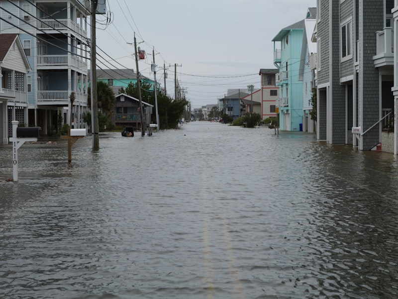
FEMA flood zones were designed primarily to determine whether federally backed mortgage holders must carry flood insurance. The methodology focuses on large-scale events: riverine flooding and coastal tidal flooding. What the maps do NOT systematically capture: surface water runoff and ponding, storm drain overflow, high groundwater, and localized depression flooding. In a city with 150+ rain days per year and dramatic topographic variation like Seattle, these unlisted hazards affect far more properties than FEMA-designated zones.
The Three Hidden Flood Risks
FEMA-zone-free properties face three primary hidden risks. First, low-lying topography: a house at the bottom of a slope or natural depression collects runoff from all higher ground around it. Even in a neighborhood FEMA classifies as minimal risk, a property sitting 10 feet lower than its surroundings may flood regularly.
Second, inadequate drainage: older storm systems (especially pre-1970s combined sewer/storm systems in Seattle) can overflow during major rain events. A flat street with poor catch basins can flood while elevated neighbors stay dry.
Third, high groundwater: areas near Puget Sound, Lake Washington, and historic wetlands have high water tables. Heavy rainfall can drive groundwater up through foundation slabs, basement walls, and crawlspaces — no surface flooding required.
| Risk Type | Cause | Shown in FEMA Maps? |
|---|---|---|
| Low-lying terrain | Runoff accumulation | Usually no |
| Poor drainage | Undersized storm infrastructure | No |
| High groundwater | Near wetlands/water bodies | No |
| River/coastal flooding | Large-scale flood modeling | Yes |
Seattle-Specific Context
Seattle's combination of factors makes this especially important:
| Factor | Why It Matters |
|---|---|
| 150+ annual rain days | Frequent saturation events, not just major storms |
| Glacially formed terrain | Abrupt elevation changes within small areas |
| Clay-heavy soils in some zones | Poor percolation, water pools at surface |
| Older storm infrastructure | Pre-1970s systems undersized for current density |
| Widespread hillside development | Increased runoff concentration into valleys |
Historically, Seattle has seen repeated basement flooding in FEMA Zone X properties during heavy rain — cases where terrain and drainage issues, invisible to FEMA maps, caused recurring water damage.
Pre-Offer Due Diligence Checklist
Before making an offer, complete this systematic assessment:
| Check | What to Do | Value |
|---|---|---|
| Topography | Observe runoff direction, look for pooling marks | Identify low-lying risk |
| Drainage | Check slope away from house, gutters, downspouts, basement waterproofing | Assess drainage capacity |
| History | Ask neighbors and review seller disclosure | Fill gaps in official records |
| Expert assessment | Drainage or geotechnical evaluation | Essential for complex lots |
For higher-value or topographically complex properties, a professional drainage and geotechnical assessment — typically a few hundred dollars — can prevent tens of thousands in future water damage.
Common Hidden Flood Scenarios in Seattle
| Scenario | Typical Signs | Common Setting |
|---|---|---|
| Slope-base runoff accumulation | Water rushing down during storms | Houses below hillsides |
| Storm drain backflow | Basement backup during rain | Older low-lying neighborhoods |
| Groundwater seepage | Perpetually damp basement, mold | High water table, soft soil areas |
| Improper roof drainage | Water tracking down exterior walls | Clogged or misaligned gutters |
These scenarios share a common thread: they are all controlled by local topography and drainage, not large-scale riverine flooding — making FEMA maps essentially useless as a warning tool.
Long-Term Cost of Water Damage
| Consequence | Impact | Approximate Cost |
|---|---|---|
| Mold remediation | Health + cleanup | Thousands to tens of thousands |
| Structural repair | Foundation, walls | Tens of thousands |
| Insurance premium increase or denial | Higher holding costs | Long-term |
| Resale disclosure requirement | Significant value discount | Ongoing |
Pre-Offer Quick Reference
| Check Item | Pass Condition | Warning Signal |
|---|---|---|
| Terrain position | Higher than or level with surroundings | Sitting in a low bowl |
| Basement condition | Dry, no odor | Damp, musty, water stains |
| Drainage direction | Slopes away from house | Slopes toward house |
| History | No water damage disclosures | Past claims or flooding history |
Summary
FEMA zones are a legal baseline, not a safety guarantee. Real flood risk in Seattle is determined by terrain and drainage — things you discover by walking the lot, checking the slope, asking the neighbors, and having a professional assessment done when warranted.
For Seattle buyers, the practical approach before any offer is: observe whether the lot sits in a low point, check slope and drainage condition, review seller disclosures for water history, and commission a drainage evaluation when needed. Understanding what you are actually buying is far more protective than trusting a regulatory map. In Seattle, terrain and drainage are the real flood risk map.